Wetin be Hurricane Melissa wey Jamaicans dey prepare for and how serious e go be
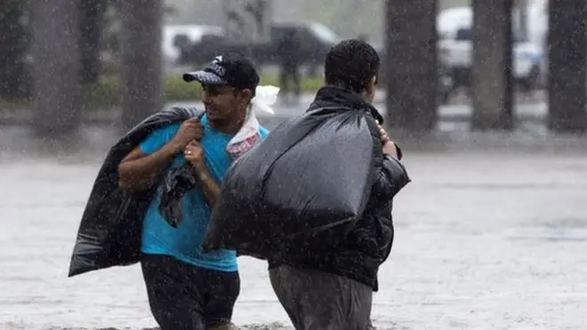
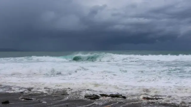
Wia dis foto come from, RICARDO MAKYN/Getty Images
- Author, Vanessa Buschschlüter
- Read am in 5 mins
Three pipo don already die for Jamaica as dem dey brace for di world strongest storm for dis year - and possibly di strongest for di island record - wit US meteorologists warning of "catastrophic and life-threatening" conditions.
Wit wind speeds of up to 175mph (282km/h), Hurricane Melissa na category five storm - di maximum strength. E dey gada momentum and e dey expected to make landfall on di Caribbean Island early on Tuesday.
Di storm don kill four pipo for Haiti and di Dominican Republic, plus di pipo wey die for Jamaica.
Experts don warn say Melissa slow pace fit mean prolonged torrential rain for some areas, wey go increase di risk of deadly flooding and landslides.
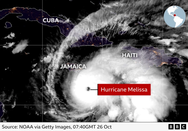
Di latest data from di US-based National Hurricane Center (NHC) show say in terms of maximum wind and low central pressure, Melissa na di world strongest storm so far dis year.
For im current strength, e go be di strongest hurricane to hit Jamaica since record-keeping start for 1851, CBS, BBC US news partner, report.
Tropical storm conditions don already dey occur for Jamaica, and "catastrophic and life-threatening hurricane-force wind conditions dey expected to start Tuesday morning," di latest NHC public advisory update tok by 23:00 ET (03:00 GMT) on Monday.
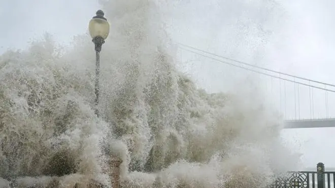
Wia dis foto come from, REUTERS/Gilbert Bellamy
Di Jamaican govment don order evacuations for parts of di capital, Kingston, and di entire island don dey classed as "threatened".
An update from di NHC at 12:00GMT say Melissa na about 135 miles (220km) southwest of Kingston, Jamaica.
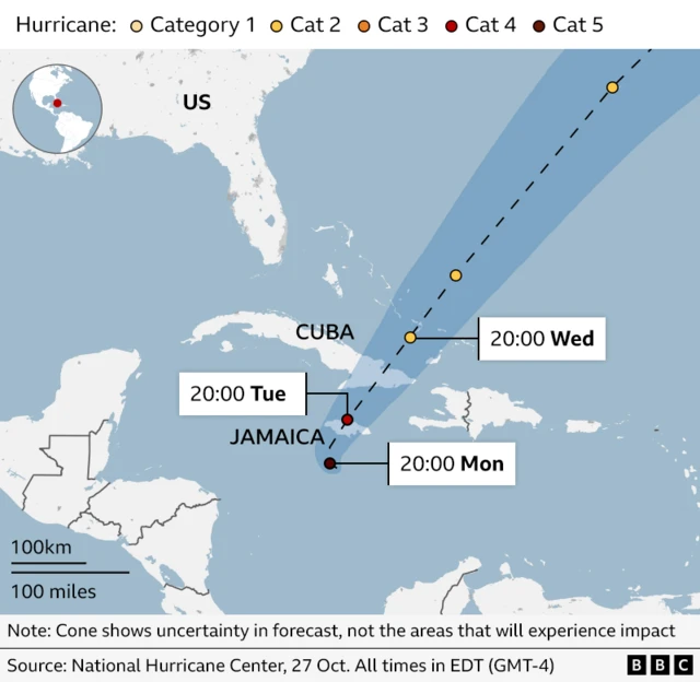
E get maximum sustained wind speeds of 160mph (260km/h) and fit strengthen further in di next 12 to 24 hours, forecasters warn.
If e continue on di forecasted track, im core dey expected "to move near or over Jamaica tonight and Tuesday, across south-eastern Cuba Tuesday night, and across di south-eastern Bahamas on Wednesday".
Di storm dey particularly slow moving, wey make am veri dangerous in terms of expected rainfall amounts.
According to di NHC, 40 inches of rain (100cm) dey possible in parts of Jamaica over di next four days.
Forecasters warn say di destructive winds and life-threatening storm surges dey expected to hit Jamaica overnight or early on Tuesday.
Jamaica Prime Minister Andrew Holness don order di immediate evacuation of several vulnerable communities across di island.
Officials also urge residents in low-lying and flood-prone areas to seek shelter for safer areas.
Jamaica Minister of Local Govment, Desmond McKenzie, tell local media say all of di island 881 shelters dey open.
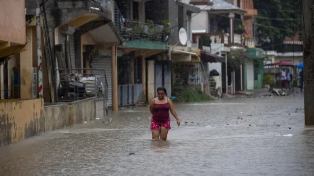
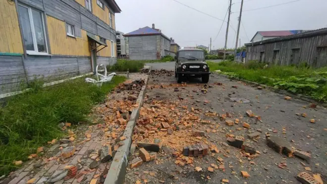
Wia dis foto come from, Orlando Barría/EPA/Shutterstock
Wetin be Hurricane Melissa?
Hurricane na type of storm wey get plenty-plenty rain plus strong wind, and sometimes sef thunder go follow join.
Meteorologists wey dey research weather mata tink say if dem give hurricane name, pipo go fit remember am well-well and e go help pipo wen dem dey tok about am.
Dis name wey dem dey give hurricane na based on list wey dem don arrange bifor each hurricane season start. US National Hurricane Centre start dis one since 1950.
Normally, na di World Meteorological Organisation (WMO) dey arrange all di name wey dem dey give hurricane.
Bifor-Bifor, na only woman name dem dey use till 1979 wen dem kon add man name.
Wen storm dey first start for di year, dem go give am name wey dey start with A and e go continue like dat.
Melissa na di 13th hurricane for dis year Atlantic season, wey go typically end for November.
Hurricane Melissa na one of di hurricane wey go hit some kontris, and e get winds of up to 120 mph (195 km/h).
E dey currently turn north-west for di Caribbean and dey expected to make landfall by Tuesday, according to di US National Hurricane Center (NHC).
Na category five hurricane wey be di strongest type, wit winds of at least 157mph.
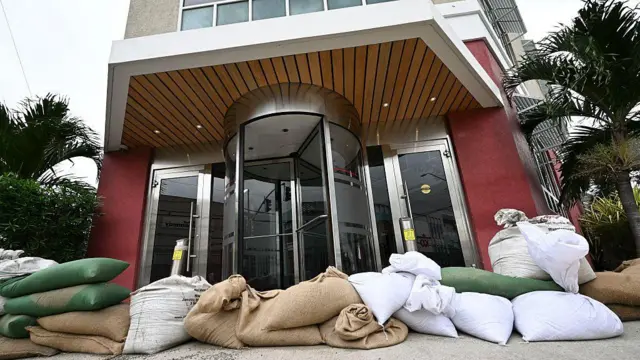
Wetin residents fit do
Authorities warn say Hurricane Melissa go lead to power cuts and damage to infrastructure sake of say Melissa go bring up to 30 inches (76cm) of rain and sea level as high as 13ft (4m) above ground.
Dem say make residents begin seek shelter, secure dia homes wit sandbags and wooden boards, and to stock up essentials for dia use.
Hurricane Melissa also dey expected to bring similar effects by di middle of next week for Haiti including di capital, Port au Prince, di Dominican Republic and eastern Cuba.
Oda hurricanes wey don happun bifor
Oda hurricanes wey don happun bifor na:
Arlene, Bret, Cindy, Don, Emily, Franklin, Gert, Harvey, Irma, Jose, Katia, Lee, Maria, Nate, Ophelia, Philippe, Rina, Sean, Tammy, Vince, Whitney